Lodging nearby Nizar Hotel
Bahrain
Lodging nearby Nizar Hotel
Nizar Hotel
Al Sayh, Bahrain
contacts phone
:
+973 1770 0787
Latitude:
26.2633911
, Longitude:
50.596179
larger map & directions
read more
nearest Lodging
31 m
Dar Al Ezz Tower
Al Sayh
Lodging
read more
64 m
Rcsi HOR
Road 2834, Al Sayh
Lodging
read more
67 m
Busaiteen Tower
Al Sayh
Lodging
read more
85 m
Signature Residences
Building 2355, Road 2834, Al Sayh
Lodging
read more
101 m
La Vida Tower
Al Sayh
Lodging
read more
174 m
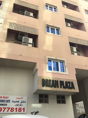
Dream Plaza
Al Sayh
Lodging
read more
216 m
Hanan Towers
Al Sayh
Lodging
read more
222 m
Busaiten Tower
Al Sayh
Lodging
read more
648 m
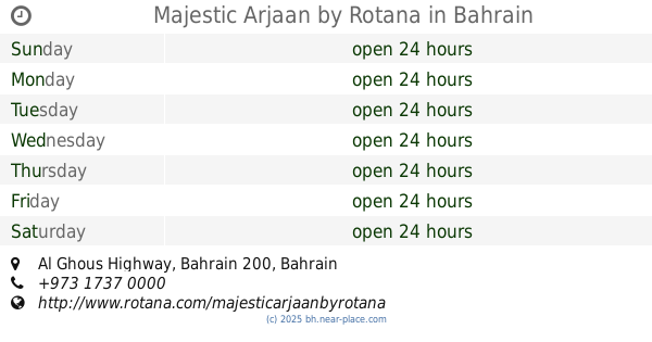
Majestic Arjaan by Rotana
Al Ghous Highway, Bahrain
Lodging
read more
1.803 km
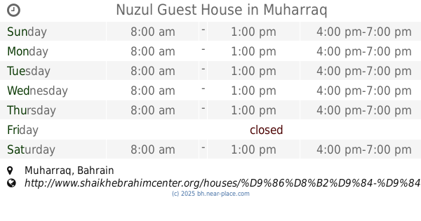
Nuzul Guest House
Muharraq
Lodging
read more
1.978 km
Redx accommodation
Sh Mohammed Avenue, Muharraq
Lodging
read more
2.098 km
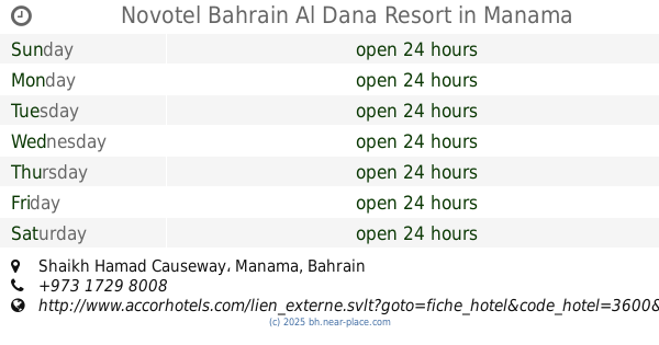
Novotel Bahrain Al Dana Resort
Shaikh Hamad Causeway, Manama
Lodging
read more
2.238 km
Crowne Plaza Bahrain
Manama
Lodging
read more
2.364 km
Human Capital House
Area, Manama
Lodging
read more
2.375 km
Pierre Salon
Manama
Lodging
read more
2.378 km
The Diplomat Residence
Diplomatic Area, Manama, Manama
Lodging
read more
2.395 km
The Diplomat Radisson Blu Residence
Bahrain Apartment, Sh Abdulla Ave, منامة
Lodging
read more
2.396 km
Fraser Suites Diplomatic Area
Road No 1701, Manama
Lodging
read more
2.505 km
The Diplomat Radisson Blu Hotel, Residence & Spa, Manama
Manama
Lodging
Point of interest
Establishment
read more
2.72 km
فندق شذى تاور
Diplomatic Area, Road No 1708, Manama
Lodging
read more
2.722 km
شذا
Road Number 1705, Manama
Lodging
read more
2.854 km
Golden Tulip Bahrain
Palace Road, المنامة
Parking
Lodging
Point of interest
Establishment
read more
2.953 km
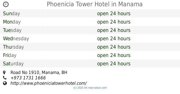
Phoenicia Tower Hotel
Road No 1910, Manama
Lodging
read more
3.776 km
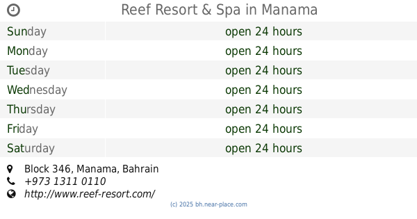
Reef Resort & Spa
Block 346, Manama
Lodging
read more
3.781 km
Reef Resort
Road 4652, SeaFront 346 Building 2875, Manama
Lodging
read more
📑
all categories
Accounting
Administrative area level 1
Airport
Amusement park
Aquarium
Art gallery
Atm
Bakery
Bank
Bar
Beauty salon
Bicycle store
Book store
Bowling alley
Bus station
Cafe
Campground
Car dealer
Car rental
Car repair
Car wash
Cemetery
Church
City hall
Clothing store
Convenience store
Country
Courthouse
Dentist
Department store
Doctor
Electrician
Electronics store
Embassy
Establishment
Finance
Fire station
Florist
Food
Funeral home
Furniture store
Gas station
General contractor
Grocery or supermarket
Gym
Hair care
Hardware store
Health
Hindu Temple
Home goods store
Hospital
Insurance agency
Jewelry store
Laundry
Lawyer
Library
Liquor store
Local government office
Locality
Locksmith
Lodging
Meal delivery
Meal takeaway
Mosque
Movie rental
Movie theater
Moving company
Museum
Natural feature
Neighborhood
Night club
Painter
Park
Parking
Pet store
Pharmacy
Physiotherapist
Place of worship
Plumber
Point of interest
Police
Post office
Premise
Real estate agency
Restaurant
Route
School
Shoe store
Shopping mall
Spa
Stadium
Storage
Store
Subpremise
Subway station
Supermarket
Synagogue
Taxi stand
Travel agency
University
Veterinary care
sublocality level 1
↑